Roley Pools - Djarlgarro
- Out and About

- Sep 14, 2022
- 6 min read
Updated: Oct 5, 2025

Roley Pools is located along the Canning River (Djarlgarro) below the Canning Dam in Roleystone. It can be accessed from Soldiers Road, Collins Road (stairs) or Thompson Road.
This is a place of Noongar stories - past present and future. Traditionally Roley Pool was an important place to gather bushfoods and hunt kangaroos but it also has a long history as a swimming hole and even had a diving board and change rooms installed here in more recent history. Construction of the Canning Dam severely impacted the seasonal flow of Djarlgarro - which means a river for all - and the pools stagnated until works were completed in the 1970’s restoring the pools to some of their former glory.
There are 3 main trails that can be explored here with a short diversion to Natures Spa from the Boardwalk Trail. We visited in early June and found the pools had water flowing but the water level was low enough to easily rock hop across to the opposite bank. When we returned in late August after a wet winter the river was flowing quite fast and was definitely not able to be crossed so your experience will depend on the water levels and rate of flow.
Roley Pools Walk Trail
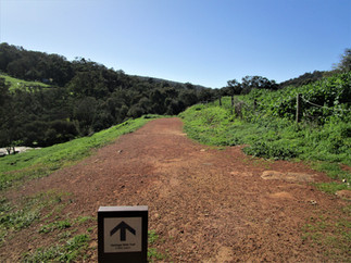
This is the trail we walked in June. We missed the turn off to the lower carpark on Soldiers Road and turned into the upper carpark immediately across the bridge. We didn't realise that the trails on each side of the river differ to some degree. Our intention had been to walk the Canning River Interpretive Trail however it starts from the lower car park. The trail on the northern bank is the Roley Pools Walk Trail which extends 500m to the Roley Pools picnic area. The gravel trail is wide and well groomed but has some steeper sections as it winds alongside the river with glimpses through the trees to a picnic hut on the opposite bank and to the large granite and dolerite boulders on the other side which we later learned mark the end of the boardwalk trail.


As you emerge at Roley Pools there is another picnic table below the rock staircase descending from Collins Road - we were going to walk up to have a look but changed our mind, later discovering that there are 91 steps! This lovely tranquil area was the site of the change rooms and swimming pools from the 1920's up until the 1960's when water flow ceased and the pools became stagnant. When the water levels are low there is lots of opportunity for kids to explore the rocks and cross to the other side. It is advisable to check the water quality with local authorities before entering the water.


Continuing east along the river the track is very rough and we didn't explore beyond where it was blocked by a tree. We still enjoyed exploring by climbing around rock outcrops, over tree roots and did some rock hopping to explore the opposite bank before turning back.


Thinking we were on the Canning River Interpretive Trail we were a little disappointed at having to return but back at the upper car park we realised we were on the wrong side of the river as we could see interpretive signs on the southern bank. Unfortunately we were out of time to do the longer boardwalk trail. The Roley Pools Walk Trail will take up to 10 minutes to walk in each direction but allow extra time to explore in and around the pools.


Boardwalk Trail
or Canning River Interpretive Trail by Roleybushcare
Next visit later in August we parked in the lower car park and headed off along the longer trail (2.6km return). This trail is also wide well groomed gravel and is flatter than the opposite side up until the old water pipe which marks the beginning of the boardwalk.
The Canning River Interpretive Trail follows the Boardwalk Trail to Thompson Road and there are interpretive number blocks which refer to the numbers on the trail brochure. There are also QR codes which you can scan for information. Roleybushcare provide some excellent information on the geology history, fauna and flora if you want to delve a little deeper into the background of this special section of river.


Once across the short boardwalk the trail traverses a flat rock at the river's edge skirting the granite and dolerite boulders we had seen from the opposite bank in June. It then narrows to a rougher trail as it follows the river passing the picnic hut we had also seen from the opposite bank. The hut can be accessed along a side trail which then leads on to the river's edge.


As you come to some large rockpiles another sidetrail leads down to Roley Pools. This visit was after considerable rain so the pools were full and flowing and there was no chance of rock hopping across this time! I think I preferred the lower water levels so you could explore the pools!


The trail continues, ascending and descending slightly but remaining high above the river so the trail itself is not impacted by high water levels but it can be muddy! The landscape opens out with fewer trees and more bushes covered in wildflowers. There are views to the properties across the valley and even a mini rock maze to negotiate!


Nature's Spa Walk
A 380m loop detour leads from the main trail down a series of steps to the river where the water flows across large flat granite rocks forming beautiful river pools.


Back on the main trail after Nature's Spa we walked a further 5 minutes to Thompson Road where this trail ends. Nature's Spa can also be reached by parking on Thompson Road and walking west to the side trail. Thompson Road is also where the Heritage Walk Trail heads east towards Heritage Road.


Heritage Walk Trail
This 3.2km return trail runs between Thompson Road and Heritage Drive. There is no parking at Heritage Drive so park at Thompson Road. We walked a short distance along this trail bypassing The Cascades to River Viewpoint, accessed via a narrow stepped trail. The river was still and serene here. Informal trails led further upstream but we didn't explore as they were quite wet. We took the staircase back to the main trail which runs alongside sheep paddocks.


A short distance back along the main trail there was an informal track through the grass leading to The Cascades. The Cascades is a large open area of granite with the water cascading over the rocks in contrast to the still water a few hundred meters upstream at River Viewpoint. It is a very pretty spot and well worth a visit. We only walked the early part of this trail but will return another day to complete the Heritage Trail beyond River Viewpoint.


In September 2025 we returned to walk the full Heritage Walk Trail from Thompsons Road (there is no parking available at Heritage Drive). Having extended our Roley Pools walk as far as the River View Point I felt that this covered the best parts of the Heritage Walk Trail and the rest of the trail rises and falls but with no connection to the river.


On our initial walk we climbed the stepped trail back to Thompson Road and retraced our steps along the Boardwalk Trail passing through stands of Flooded Gums, Wandoo and Marri trees with Paperbarks closer to the river's edge. The trail took us just over an hour to explore including 10 minutes on the Heritage Walk Trail. We didn't spend as much time exploring the rocky areas along the river this time as the water levels were quite high and rock hopping was not an option but if water levels had been lower we would have spent a bit more time here.


Whilst Djarlgarro has changed much over time it has always been an important resource and a place of cultural and spiritual significance. The community are still culturally and spiritually connected to Djarlgarro and are working together to restore balance. Please tread lightly in this special place.
There are no toilet facilities along these trails but toilets can be found nearby in Roleystone which is a beautiful area with it's steep wooded hills and seasonal splashes of autumn colours or spring blossoms. Head over to the manicured gardens of Araluen Botanic Park or pack a picnic and visit Canning Dam or Churchman Brook Dams which are a few minutes drive away or visit the orchards and fresh produce stalls in season.
The City of Armadale publishes a leaflet detailing the Roley Pool Walks and you can download a copy from their website or from the Roleybushcare website.

Orange: Roley Pools Walk Trail
Yellow: Boardwalk Trail or Canning Rive Interpretive Trail
Purple: section of Heritage Walk Trail from Thompson Rd to River Viewpoint and The Cascades.

To read more blogs go to:
I love wandering along trails, both marked and unmarked, and sharing my discoveries with my Out and About FNC community. If you enjoy reading my blogs please consider a small donation which will be used towards the costs of keeping the website up to date and relevant.

In the spirit of reconciliation Out and About- Family Nature Connection acknowledges the traditional owners of the Wadjak boodjar (Perth land) and their connections to land, sea and community. We pay our respect to their elders past and present and emerging and extend that respect to all Aboriginal and Torres Strait Islander peoples today.
As always when hiking in the bush please help to reduce the spread of Phytophthora Dieback by sticking to the tracks and paths, staying out of quarantined areas and, if possible, clean your shoes before and after hiking. A spray of 70% methylated spirit and 30% water can be effective.


Comments