Salter Point Lagoon
- Out and About

- Jun 27, 2020
- 4 min read
Updated: May 25, 2025

This is a stunning walk following Djarlgarra, the Canning River, downstream from Sandon Park. The walk from Sandon Park to Salter Point Lagoon, at just over 1km in each direction, will take around 15 minutes each way however if you add in the Lagoon Loop and the River Walk it will extend your walk to around an hour.
Parking is available on the eastern side of Sandon Park off Elderfield Road. You will find a traditional playground here along with public toilets, picnic facilities and BBQs - all of which offer spectacular river views. You can also walk up river from Sandon Park following the Waterford Foreshore Reserve Trail to Bodkin Park through the Andrew Thompson Conservation Reserve and on to Clontarf.

On the river side of the Scouts building you will find a wooden bridge over the channel. Cross over and you can choose to walk along the grassy foreshore or you can cross the grass to the boardwalk on the Melaleuca Grove Loop marked by turtle trail markers. This trail takes you on a short boardwalk through a melaleuca grove.
If you need a coffee fix or a snack you can follow Letchworth Centre Avenue, across from the turtle trail, for about 200m (uphill) to Raktacino. If you continue along Letchworth Centre Avenue you will hit Redmond Street and you can follow this down to the pocket park at the top end of the River walk however my recommendation is to walk along the river in both directions as you get spectacular but different views in each direction.
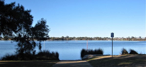
There are plenty of 'snakes live here' signs along the paths so walk your dog on lead and keep young children close. On a magnificent winter's day we weren't too worried but still kept an eye out as wetlands are tiger snake country. The walk through Salter Point Reserve offers wide open spaces along with wide open views up and down the river.
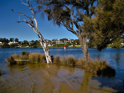
Salter Point Lagoon is a small lagoon surrounded by reeds, sheoaks and paperbarks and it is a haven for waterbirds. We saw several beautiful white egrets.
The Salter Point Lagoon Loop Trail is up to 500 m long but accessibility depends on water levels. The trail is narrow and sandy on the eastern side of the lagoon. We followed it in but found the path flooded at the river end. It looks as though the trail might loop around to the point when the water levels are much lower in summer but on this day the only way across was swimming! We backtracked and followed the main paved path to the western side of the lagoon.
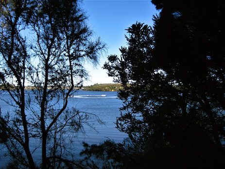
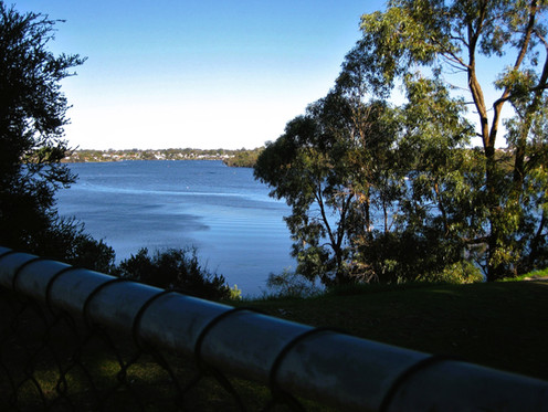
The western section of the trail is marked by a Lookout sign at the entrance. The trail is wider and partly compacted but there are patches of loose sand before a section of boardwalk. The trail meanders around the edge of the lagoon with lovely views in both directions across the lagoon and down river across Aquinas Bay to the Mt Henry Bridge in the distance.
The Canning River is quite narrow at this point where the Salter Point spit juts out and the houses on the opposite bank in Shelley and Rossmoyne are clearly visible. From the tip of the point you get 360 degree views of the river.
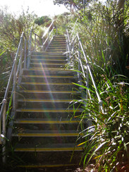
Don't stop here though as the best part is yet to come. Continue to follow the path west alongside Salter Point Road to where the road loops around. A plaque here acknowledges the heritage of Salter Point on which Samuel August Salter established a timber mill so he could send his timber to market by barge. Follow this gorgeous flat trail for about 600 meters past shady little river beaches with fabulous views down river across Aquinas Bay to Mt Henry Bridge. You will pass a metal staircase but keep going until you get to the very pretty boardwalk and the end of the trail at the bottom of a very steep staircase.
The treads on this staircase are quite narrow and the bottom steps are concrete so can be a little slippery if wet and sandy. Climb up the stairs for great views down river from the little pocket park at the top on River Road (corner Redmond Road). Unfortunately the riverside land downriver is privately owned so you are not able to walk further around the bay.
Once you have climbed the stairs for the view from the top head back down to retrace your steps.
The River Walk from Salter Point Road is just over 1 km return and will take about 20 minutes to walk.

To read more blogs go to:
I love wandering along trails, both marked and unmarked, and sharing my discoveries with my Out and About FNC community. If you enjoy reading my blogs please consider a small donation which will be used towards the costs of keeping the website up to date and relevant.

In the spirit of reconciliation Out and About- Family Nature Connection acknowledges the traditional owners of the Wadjak Boodjar (Perth land) and their connections to land, sea and community. We pay our respect to their elders past and present and emerging and extend that respect to all Aboriginal and Torres Strait Islander peoples today.











Comments