Mosman Park Heritage Trail - Minim Cove to Keanes Point via Buckland Hill and Memorial Park
- Out and About

- Mar 24, 2024
- 7 min read
Updated: May 25, 2025

The Mosman Park Heritage Trail explores some highlights of Mosman Park's history while highlighting the beautiful scenery of this unique municipality between river and sea. Once an isolated country town and then home to large scale industry much of the open bushland and industry that once defined Mosman Park has been replaced by residential developments. As you wander the leafy peppermint tree lined streets of this quiet suburb you can see it's history reflected in the blend of small worker's cottages, solid 1930's houses, bland 1960's homes, utilitarian multistorey apartment blocks and more recent modern homes and mansions. Many of the streets have quaint little back laneways leftover from the old outdoor toilet days.


This walk is a continuation of our walk from Keanes Point Reserve at Freshwater Bay to Minim Cove on the Mosman Park Heritage Trail. The full trail is 10.5 km long so we have broken it into sections, conveniently breaking at Minim Cove - home to Russell Brown Adventure Park which is a fabulous all natural nature playspace. There are toilets here and picnic tables and you can park at the Mosman Park Tennis Club car park.


After exploring the nature and water play at the park follow the path west along the river. Before you leave the flats explore the path on the right which features collaborative artwork by school kids illustrating various aspects of local history including the fossils, indigenous past, native animals and plants, industry, early settlement, farming, sport and war.


At the top of the hill where paths intersect take the left hand path next to the Minim Cove interpretive sign. Minim Cove was an important Noongar camping and fishing site and tools have been found here dating back 9,930 years. In 1839 the first land grant following European Settlement was granted and the area was known as Billy Goat Farm, being used as a dairy and picnic spot.
This path is part or the Wardun Beelier Bidi Trail and you will see the triangular seahorse marker in the path. Follow the path down around the large power pylon and you will come across a rough staircase leading to a small jetty. The original jetty was used until the 1920's by a ferry service linking Minim Cove to Preston Point before a bridge was constructed at Fremantle.


The lower path hugs the edge of the river which has steep cliffs as you head back along along Minim Cove passing the site of the Fertiliser Factory and with magnificent views down the Swan River to Rocky Bay and the Old Soap Factory. Continue on to Garungup Park with it's decorative panels depicting the History of River Industry prior to redevelopment. Garungup is the Noongar name for two caves in the bay to the west, said to be the final resting place of the Waugyl before it tunnelled underneath the limestone cliffs to Gabee-Wardun, the Indian Ocean.
This area was the site of the Rocky Bay Quarry between 1895 and 1909 providing limestone for the construction of Fremantle Harbour. In 1909 the Mt Lyell Chemical Works leased the quarry site and produced superphosphates and acids. When they moved to Kwinana in 1969 as CSBP, they demolished the industrial complex and cleaned up the site but further work was required as the site was so contaminated and 225,000 cubic metres of contaminated soil was removed prior to redevelopment as a residential area in 1995.


Take the lower path down to the gazebo and explore the stairs down to tiny Milo Beach. Head up the stairs from the gazebo to explore the landscaped gardens for a little bit before heading back east along the upper pathway, Masson Mews, which then winds up the hill and on to Edwards Parade. There are some smaller car parks here.


At Pethybridge Heights take a detour east into Mt Lyell Park which has interesting artworks and a lookout with fantastic 360 degree views across the Swan River. If you have kids in tow you may wish to divert to the Spider Sculpture Park for a quick play.


From My Lyell Park return to Edwards Parade to resume the Mosman Park Heritage Trail through Swansea Park, around the tennis courts and into Buckland Hill Park where you will find Leighton Battery and the Buckland Hill Tunnels established during WW2. The gun battery was established to overlook and protect Fremantle Harbour and there are stunning 360 degree views from the raised platform. On a previous occasion we have done the tour of the tunnels on a Sunday, delving deeper into the fascinating history of this important defence post during WW2.


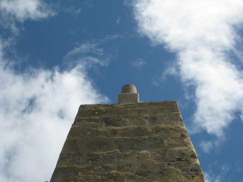
Loop back along Boundary Road where you will see Monument Hill ahead of you with it's obelisk (not worth the detour). Buckland Hill, also known as Monument Hill, was scaled by Willem de Vlamingh in 1697 and by Capt James Stirling in 1827, providing these early explorers with sweeping views over the Swan River mouth. Buckland Hill is the only remaining hill of what was once known as the Seven Sisters with all the other hills being reduced by limestone quarrying. There has been an obelisk, in one form or another, here since 1850 providing a navigation aid to ships entering the Swan River from the ocean. During WW1 the area around the obelisk was used as a signalling station. It has also been used as a limestone quarry and has a reservoir, established in 1924. Boundary Road was home to a rest and recuperation station for Navy crews during the second World War.


Wander through Rope Works Park and along a section of The Rope Walk which reflects the 330m long covered pathway used to stretch out lengths of rope in the days when this was the site of the Rope Works from 1912 to 1990.


Head along Village Place and then Buckland Avenue to arrive at the site of the old GM Factory, now Iona Presentation College Junior Campus. The GM Assembly Plant was established in 1926 and operated through to 1973 producing six cars every hour. During WW2 the plant converted to assemble aircraft wings and other military equipment before reverting to car assembly.


Follow Victoria Street to Solomon Street, site of Mosman Park Primary School. If you are walking the trail outside of school hours pop into the school grounds at the rear to see colourful murals and the nature based playground and skate park backing onto Mann Oval. Continue past the Alf Adams Pavilion where there are toilets (locked on the day we walked the trail).


Wander across Mann Oval and walk around the old Town Hall built in 1921. The original Edwardian building was renovated in Art Deco style in 1939 and is now the Camelot Arts Centre. Across the road is a cafe with a cute mural.


Follow Lochee Street west to Monument Street to the site of The Oceanic Hotel on the corner of Glyde Street. The Oceanic Hotel was originally built in 1908 and has more recently been converted to apartments. Opposite on Glyde Street check out the sculptures at Gallows Gallery.


Continue along Monument Street to St Luke's Anglican Church Precinct and Alexandra Hall. St Luke's was originally built in 1897 but has been extended since then. Alexandra Hall was built in 1903 and used for Sunday School and community gatherings. Nearby at 1 Willis Street you can find the Old Rectory built in 1899.


The trail loops back via Bond Street and Harvey Street to Glyde Street. Keep going past Wright Park and turn right at Palmerston Street and through the gates along Memorial Drive in Memorial Park, home to the Town of Mosman Park buildings. Memorial Park honours the military service of Mosman Park residents and was established in 1934 with the wrought iron Memorial gates (1935) and the driveway lined with Norfolk Pines commemorating those lost in WW1. The rotunda with it's views across the river to the city skyline, was built in 1952 to commemorate those lost in WW2. The administration centre was built in 1965 after the Town of Mosman Park was created in 1962. The administration building, the fountains and the rotunda were all designed by Marshall Clifton although built more than 10 years apart. The Lone Pine was planted in 2008.


If you cross Bay View Terrace from Memorial Park you are in Jabe Dood Park and you can wander down hill and along the Mosman Bay Foreshore Park to Keanes Point or you can follow Bay View Terrace downhill past the lovely grounds of St Hilda's Anglican School and magnificent mansions with river views, to Manners Hill Park and Keanes Point.


This closes the loop trail which we walked in two sections. The full trail is 10.5km which will take about 3 - 4 hours to complete. Todays walk from Russell Brown Adventure Park to Keanes Point took us around 2 hours.
Parking is available at a number of locations along the way including Keanes Point, Manner Hill Park, Memorial Park, Mann Oval and Buckland Hill. The only reliable toilets are at Russell Brown Adventure Park at Minim Cove and at Keane's Point/Manners Hill Park.

To read more blogs go to:
This walk can be combined with a number of activities and trails in the area:
I love wandering along trails, both marked and unmarked, and sharing my discoveries with my Out and About FNC community. If you enjoy reading my blogs please consider a small donation which will be used towards the costs of keeping the website up to date and relevant.
In the spirit of reconciliation Out and About- Family Nature Connection acknowledges the traditional owners of the Wadjak boodjar (Perth land) and their connections to land, sea and community. We pay our respect to their elders past and present and extend that respect to all Aboriginal and Torres Strait Islander peoples today.


Comments