Walking Subiaco - The Triangle
- Out and About

- Dec 13, 2023
- 6 min read
Updated: Apr 27

The City of Subiaco provides residents and visitors with 8 self-guided walks through different areas of Subiaco and adjoining suburbs. Download maps here. The Triangle explores Subiaco's earliest residences with heritage homes set along streets shaded by mature street trees.
The Triangle walk begins at the Council Chambers situated in Rankin Gardens, named after Alexander Rankin, Subiaco Town Clerk and Engineer from 1898 to 1911. The gardens are the location of the Subiaco War Memorial and Peace posts.


Start your walk by walking east along Bagot Road to Rupert Street, passing the Cloisters Apartments (2002) which reflect the architecture of the Subiaco Methodist Church that once stood on this spot. Continue past the Subiaco Community Centre built in 1967 after many years of voluntary fundraising.


Continue eastwards along Bagot Road, then turn into Salisbury Street. This area has many heritage homes with decorative plaster work, chimney moulding and bull nosed verandahs. Salisbury Street is notable as a substantially intact streetscape of the early 20th century.

Cross Heytesbury Road, which is lined with mature peppermint trees and walk westwards to Rupert Street, which takes you through to Nicholson Road.

Nicholson Road Reserve was once home to croquet lawns and bowling greens and is now home to the petanque club, tennis courts, a play group, BMX and skateboard ramps and the Subiaco Police and Citizens Youth Club.
Turning eastwards, walk along Nicholson Road towards the Salisbury Street intersection where you will find the Avro Clinic. Originally called Hamel House this was the home of hotelier Fred Jacoby whose son Wilson Jacoby flew an Avro Anson which was shot down during the Second World War. He survived and salvaged the plane’s brass name plate which was later fixed to the front of his father’s house, changing its name to Avro. The house later became a private hospital and is now a community health centre and outpatient psychiatric clinic.

Walk through to Finlayson Street via the laneway behind the Avro Clinic and then follow Finlayson Street northwards, cross Heytesbury Road and turn north along Chester Street. This street also has many heritage homes which feature multi-coloured leadlight glasswork in their front doors. Subiaco is reputed to have the finest domestic examples of early 20th century leadlight windows in Australia.
At 18 Chester Street, past the tennis court, a plaque in the footpath marks the entrance to ‘Stratmore’ built in 1905 and home for many years to the Durack Family, well known explorers and pastoralists.


Cross Hamersley Road at the end of Chester Street and enter Robinson Street where there are more heritage homes. At the Bagot Road end of Robinson Street, the Mayflower Homes occupy the corner position on your left. The Rev. AC Hawke, father of former Australian Prime Minister the Hon. RJ Hawke, was the last minister of the Subiaco Congregational Church which stood on this site until 1975 when the Mayflower Homes were built by the Uniting Church, formed in that year by the uniting of the Methodist, Congregational and Presbyterian Churches of Australia. The complex is now named Mayflower Lodge.

The trail then winds through the side streets passing more decorative heritage homes. The triangular location bordered by Hamersley Road, Townshend Road and Thomas Street was the site chosen in 1901 for the Home of Peace, a hospital for the chronically ill and frail aged. The hospital was extended during the twentieth century eventually occupying the entire area. In 1997 the name Brightwater was adopted and in 2001, the organisation’s centenary year, an entirely new facility was opened, occupying part of the original site.

From here the walk continues along Hamersley Road to Thomas Street. with the Kings Park bushland on the opposite side of Thomas Street. Originally called Perth Park, the name was changed to Kings Park in 1901 following the accession of King Edward VII to the British throne.
At 103 Thomas Street you will find the three storey block of flats called ‘Attunga’ (1937) built in the art deco style. While the flats are architecturally unusual my preference would be to skip Thomas Road as it is a busy road and not all that pleasant to walk along, however short the distance.


At Thomas Road I would scoot down the cul de sac which is Bedford Avenue through to Bagot Road and then turn right to pick up the trail again at Coghlan Road. Number 129 Coghlan Road is an unusual two storey house and across the road several multi-storey red brick buildings comprise the Wandana Apartments (1956). This extensive complex is a notable part of the wide range of housing options available to the residents of Subiaco. Built in the Post War International Style, the Wandana Apartments were entered into the Heritage Council’s Register of Heritage Places in 2000. This large public housing complex, consisting of 242 apartments, was designed by architect Harold Kranz.

Walk along Coghlan Road and turn into Barker Road then walk westwards. We made a small detour here to wander a few blocks further to Mueller Park on Roberts Road.
Mueller Park is a lovely grassy area with intersecting pathways and a fully fenced all abilities playground. From here you can also see the Old Boiler House chimney stack rising 53m on the former Princess Margaret Hospital site. A new artwork is being painted on the chimney stack (Dec 2023) by Momo and Abdul Abdullah. Called Here Together it celebrates the communities sense of connectedness.


Back on Barker Road there are 1940s ‘Californian Bungalow’ style houses. which include garages illustrating the fact that the family car had become an important consideration in domestic architecture. The street numbers suggest that in order to build houses of this size it was necessary to amalgamate two allotments.
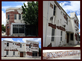
If you want you can detour by turning left at Bedford Street, passing the Park Street Mini Park before continuing along Park Street. Be sure to make another detour at Olive Street heading to the corner of Churchill Avenue for these magnificent murals by Jerome Devonport which reflect the stained glass art on the Olive Street entrance to the building.


Otherwise the trail continues westwards, left into Olive Street then right into Park Street. Many of the oldest houses in Subiaco are to be found in this area. Some were built in the 1890s and others in the first decade of the twentieth century. The Ida Cottages (1897), four single storey ‘row houses’ located at 102 to 108 Park Street were built by James Gaul using hand made bricks and are the only remaining example of a row of houses of this type and period in Subiaco. Across the street are numbers 101 and 105, built in 1907 by FE Sedgley. The houses and cottages in Park Street create an atmosphere sometimes compared with Sydney’s Paddington.


Continue westwards along Park Street to Richard Diggins Park, named after Richard Diggins JP, Mayor of the City of Subiaco from 1978 to 1989, who actively supported the preservation of the City’s historic buildings. Some of the new houses in Park Street have been designed not to replicate, but to blend sympathetically in terms of materials, colour and design with the older homes. This park is featured in the Subiaco Children's Adventure Map.


At Axon Street turn right and walk downhill to the Churchill Avenue intersection. Set in a niche, high on the two storey building at the intersection of Axon Street and Churchill Avenue, you will see the statue of a dog called Top set in to the roof space of the Top Dog Mews apartments. The statue commemorates the contribution of sheep dogs and the wool industry to Australia.


Retrace your steps to Barker Road to see St. Andrews Church (1906) with it's beautiful stained glass windows.


Cross behind the church and past the carpark where you will find some murals - for more artowrks in Subiaco view the Subi Art Discovery Trail blog.


As you pass through the arches at Postal Walk on the way to Rokeby Road take note of the recently revitalised artwork The Ceramic Snake. Originally set into the pavement in 1997 this ceramic artwork represents aspects of the local history of Subiaco, including Indigenous and European elements. Children from Subiaco, Jolimont and Rosalie Schools and Perth Modern School made the tiles with assistance from artists Jenny Dawson and Sandra Hill.

As you reach Rokeby Road, turn left and walk towards Bagot Road and return to the starting point at the Council Chambers and Rankin Gardens.

The Triangle walk took us about 60 minutes plus a 10 min walk each way for our detour to Mueller Park. It is a pleasant walk through Subiaco's beautiful leafy heritage streets with points of interest along the way to keep you motivated. You can find maps and information for the Walking Subiaco self guided walks at: https://www.subiaco.wa.gov.au/see-do/things-to-see-do/self-guided-walks or read my blogs:
To read more blogs go to:
I love wandering along trails, both marked and unmarked, and sharing my discoveries with my Out and About FNC community. If you enjoy reading my blogs please consider a small donation which will be used towards the costs of keeping the website up to date and relevant.

In the spirit of reconciliation Out and About- Family Nature Connection acknowledges the traditional owners of the Wadjak boodjar (Perth land) and their connections to land, sea and community. We pay our respect to their elders past and present and emerging and extend that respect to all Aboriginal and Torres Strait Islander peoples today.


Comments