Bickley Reservoir Walk Trail - Orange Grove
- Out and About

- Sep 18, 2022
- 5 min read
Updated: May 28, 2025

This 3.2km trail starts at the Hardinge Park picnic area which has a small playground with entrances shaped like the Mason & Bird Tramway bridge. The car park here is quite isolated and there is evidence of car break ins so remove all valuables and leave all your interior compartments open to discourage would be thieves.
The trail shares this section with the Kattamordo Heritage Trail and takes you parallel to Hardinge Road passing Bickley Brook Reservoir and then the Bickley Outdoor Recreation Camp.
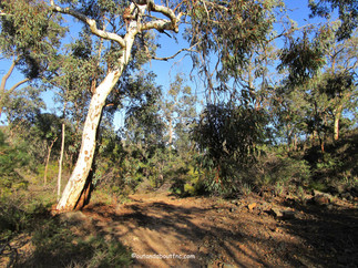
Immediately after the Bickley Outdoor Recreation Camp there is a sign for the Kattamordo Track and if you have a keen eye you will see the degraded Bickley Reservoir trail marker pointing to a small side track which follows the fence line. The track then crosses a bridge and follows the brook. The narrow trail is very pretty but quite rough with scrub encroaching on the trail. The wildflowers were not out yet in June but in spring they would make this trail magical - just be sure to use some DEET as protection against ticks as it's impossible to avoid brushing up against the foliage. Long sleeves are also recommended as some of those bushes are prickly! And a lot are at kid height. We used our walking poles to catch any early morning cobwebs strung across the trail.
The brook opens out and you can wander across the rocks but these could be slippery when water levels are high. The trail meets a wider fire trail where you can also cross the brook and follow the track up to Hardinge Road - a good alternative if you want to see the brook but don't want the challenge of the next section.
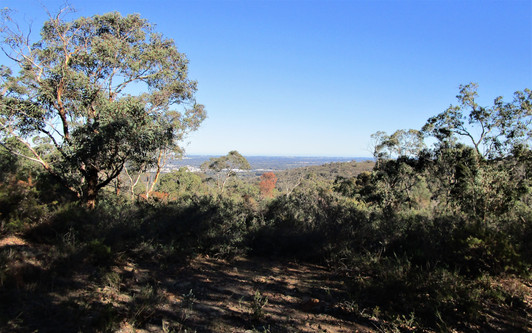
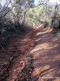
The fire trail is a very badly eroded track and it climbs steeply. Our trail directions told us to turn left so when we saw a faint track to the left next to a tree with a Shire of Kalamunda sign on it we followed it. It was okay for a little while but became more and more overgrown. We followed it for about 5 minutes until we had views over Bickley Reservoir but after that the track was too overgrown to navigate so we retraced our steps to the main trail disappointed that the trail was so badly maintained!
Luckily we decided to climb the rough fire track to the crest and we discovered the actual turnoff a few hundred metres further up so we resumed our hike turning left to complete a clockwise loop. It was very rough most of the way and although we had one hiking pole on occasion we wished we had brought two along. In some places the track was churned up by vehicles which we assumed were rangers checking on the European Wasp baits that we saw along the way.
As the trail passes through a she oak grove there is a small side trail to a granite outcrop - this was the place noted in the trail notes with views over Bickley Reservoir. We looked for orchids but in late June it was still too early.
The bush around us was beautiful and the only noise was bird song and the rustle of the trees.
A little further we stopped to enjoy the view across the coastal plain and another couple of hikers overtook us so we didn't have the place entirely to ourselves!
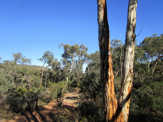
From here the trail descends through wandoo forest into the valley before climbing again on another steep and rough climb.
The ascent was relieved somewhat by a rest on a flat granite outcrop where we enjoyed views down the valley before more relentless uphill hiking finally emerging at a 4 way intersection!
The environment is similar to another trail in Korung National Park - the Lions Lookout Trail - but is much rougher! We later saw on the map that the trail north from the intersection would eventually link to the Lions Lookout Trail. We, however, gladly took the right hand track and began to descend with views of Victoria Dam in the distance. These tracks become running streams when it rains so sections were quite muddy, sticky and slippery. I wouldn’t want to attempt this trail after heavy rain. Trail markers were very degraded and there were not many and the one on the fallen tree was pointing in the wrong direction!
The track gradually descends closing the loop at the intersection where we turned left and then stepping across the rocks to cross the brook and climb up the short section to emerge back on to the main Mason and Bird/Kattamordo Trail just east of the sign.
From here you could wander east along the Mason and Bird Trail for a further 15 minutes to the scenic Munday Brook Bridge or continue further to complete the 4km Mason and Bird Heritage Trail (or the 27km Kattomordo Trail!)
We were intrigued by strange noises as we climbed back to Hardinge Road and then saw some remote control 4WD cars coming towards us. That also explained the strange circles we found on the main trail.
The trail took us 1 hour and 45 minutes to complete even though it is only 3.2km long. We did have a short 10 minute detour on a false trail. Trail markers were pretty much non existent and although there are very few intersecting trails you will need a digital or paper trail map to follow.

Orange Trail is the Bickley Reservoir Walk Trail. You can see the green trails that link it to Lions Lookout to the north.
Yellow Trail is the Mason and Bird Heritage Trail (4km each way) but you can also just walk the first 1km to the Munday Brook Bridge or you can continue on to walk the Victoria Dam Loop Trail.
Download Trail notes from the Trails WA website
https://trailswa.com.au/trails/trail/bickley-reservoir-walk
To read more blogs go to:
I love wandering along trails, both marked and unmarked, and sharing my discoveries with my Out and About FNC community. If you enjoy reading my blogs please consider a small donation which will be used towards the costs of keeping the website up to date and relevant.

In the spirit of reconciliation Out and About- Family Nature Connection acknowledges the traditional owners of the Wadjak boodjar (Perth land) and their connections to land, sea and community. We pay our respect to their elders past and present and emerging and extend that respect to all Aboriginal and Torres Strait Islander peoples today.
As always when hiking in the bush please help to reduce the spread of Phytophthora Dieback by sticking to the tracks and paths, staying out of quarantined areas and, if possible, clean your shoes before and after hiking. A spray of 70% methylated spirit and 30% water can be effective.


Comments