Lions Lookout Walk - Korung National Park - Lesmurdie
- Out and About

- Jul 17, 2021
- 4 min read
Updated: May 28, 2025

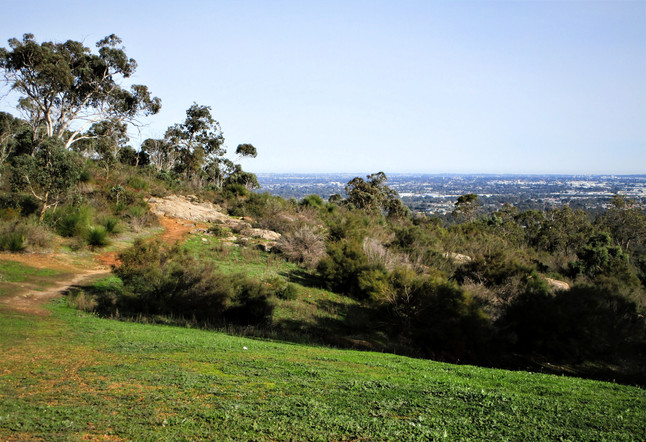
This trail in Korung National Park is categorised as a difficult walk as it has some very steep and rough sections. We found it manageable, especially with walking poles, even after some very wet weather. The 4km trail starts at a small carpark at Lions Lookout off Welshpool Road in Lesmurdie where you are immediately rewarded with vistas across the Perth Coastal Plain.
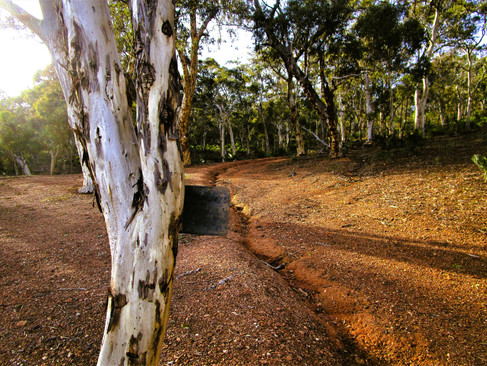
Using our trail notes from the Shire of Kalamunda, (as we find trail markers on Shire of Kalamunda walks very unreliable), we headed past the gate at the blue tree following the track a very short distance to the first intersecting track. From here you can see across the coastal plain to Perth City in the distance.


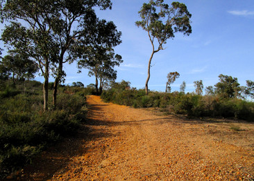
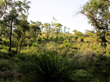
Taking the left fork the trail continues uphill a short distance before levelling out. We encountered the first of several muddy pools on the track but managed to get around all of them without getting our toes wet. Wildflowers were already out (early July) giving the bush a faint tinge of colour. The trail continues to wind along the ridge and then downhill through Wandoo woodlands. You have sweeping views over the coastal plain and can also see a track in the distance which, as we discovered, is the track you descend on your return.


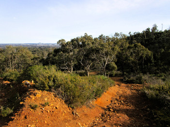
At the crossroad we continued straight ahead and it was here we encountered the roughest, steepest part of the trail. We side stepped our way up just to be extra cautious. Just as we got to the top we startled some kangaroos and they hopped across the trail disappearing into the bush. There is a fallen log here which points towards the city views. Our trail notes advised us there was a tree marker at this crossroad but we had to double back to find it - well we assume the metal on the tree was a marker!


This area is beautiful as you climb gradually through woodland to another crossroads. The trail notes say to turn right and follow the mesh fence bordering the Kanyana Wildlife Sanctuary. There is a very helpful arrow painted on the track pointing to the right fork of the trail. There is also a very unhelpful sign reading Lions Lookout and pointing in the opposite direction. We turned right but couldn't see a fence line and eventually came to a communication tower. There was no trail to our right so we headed left for a short distance coming to another intersection. Here we turned right in a westerly direction. We found the trail notes confusing and some trail markers would have helped!


On reviewing the trail notes as I write this blog I realise we had turned too soon and missed the section of the track which passes Kanyana. So don't follow the white arrow or red Lions Lookout sign - follow the trail map. The Trails WA map clearly shows the main and side trails - or use the interactive GPS maps rather than the printed PDF from the Shire of Kalumunda.

Fortunately we came across a local walking his dogs a little further along and he confirmed we were still on the right trail. There are a number of intersecting tracks through here so you need to have an idea of where you are heading. The track headed downhill before levelling off where you got a glimpse of the Bickley Reservoir deep in the valley below.


As we walked along the ridge the red dirt track changed to a whiter sand and the trees became more sparse but we were soon descending back through woodland along a rough red track with city views re-emerging.


At the bottom of the descent we finally saw a pale blue trail marker on a tree pointing to the right fork at the junction.


The track climbed gradually through beautiful forest with some granite outcrops before we met up with the tail of the walk again and retraced our steps back to the car park.


We enjoyed a coffee from the coffee van in the car park and sat down to enjoy the city views. The grassy areas are ideal for a picnic or you could use the picnic tables and barbecues while the kids explore the nearby rock outcrops but there are no toilet facilities here.


The trail took us around 70 minutes to complete but as it turned out we took a bit of a shortcut so allow 90 minutes. We really enjoyed this trail and I imagine it is spectacular in spring. If you time your walk for the afternoon it would be rather lovely to watch the sun setting as you walk the last few kilometres.

To read more blogs go to:
I love wandering along trails, both marked and unmarked, and sharing my discoveries with my Out and About FNC community. If you enjoy reading my blogs please consider a small donation which will be used towards the costs of keeping the website up to date and relevant.

As always when hiking in the bush please help to reduce the spread of Phytophthora Dieback by sticking to the tracks and paths, staying out of quarantined areas and, if possible, clean your shoes before and after hiking.
In the spirit of reconciliation Out and About- Family Nature Connection acknowledges the traditional owners of the Wadjak boodjar (Perth land) and their connections to land, sea and community. We pay our respect to their elders past and present and extend that respect to all Aboriginal and Torres Strait Islander peoples today.


header.all-comments