Walking Subiaco - Jolimont and Daglish
- Out and About

- Feb 10, 2024
- 5 min read
Updated: May 24, 2025

A day's reprieve in the middle of a heatwave had us heading to Jolimont to enjoy this short walk through the leafy green streets with a couple of playgrounds along the way.
The trail starts with Number 1 - McCallum Avenue Precinct located opposite Daglish Railway Station (1924) on Stubbs Terrace. Parking is limited here so we started from Mabel Talbot Park but I will write the blog in the correct order starting with 1 as the trail can be picked up anywhere along the route.
McCallum Avenue was unusually wide as it was a turning circle for horse drawn wagons. There is now a small park located at the corner of Stubbs Terrace. It has a small nature playground and if you venture in you will see a wall mural by HPM on private property .


From Stubbs Terrace turn left onto Willcock Avenue. Keep an eye out for leadlight windows and decorative brickwork on the 1930s era homes along this street.


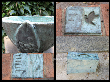
Cross Troy Terrace into Jolimont and wander through the lovely shaded Jersey Street Nature Playground before following the eastern side of Jersey Street north to the intersection with Hay Street where you will find 2.Dom Serra Grove, used in the early days of European settlement as a burial ground for typhoid victims. Graves were transferred to Karrakatta Cemetery in 1906. The olive grove was planted in 1980 to honour Dom Serra, leader of a group of Benedictine monks who established the New Subiaco Monastery in the 1850s. The Benedictine mission included the cultivation of olives, vineyards and orchards.


Cross Hay Street and then Jersey Street and find Cadigan Street, hidden behind the bushes but running immediately parallel to Hay Street. Turn right onto leafy Rosebery Street and keep an eye out for some original timber cottages which still exist in this lovely street. At the end of the street you arrive at 3. Mabel Talbot Park with the shaded playground to your right.


Wander around beautiful Mabel Talbot Park enjoying the bird life, the new family of ducks that has moved in and the peace and tranquillity.


The wetlands and lakes found in this area are of religious significance to the traditional owners, the Noongar people, as part of Aboriginal spiritual dreaming. The wetlands were also a source of food and water for Aboriginal people who lived in this area, moving with seasonal changes along the Swan River and Swan Coastal Plains.
In the early days of European settlement this wetland was known as Perry's Watering Hole after Joseph Perry who grazed cattle at this location. When the area was subdivided and named Jolimont Estate in 1891 it became Jolimont Swamp .Water from stormwater drains discharged
into the area and flooding became a serious problem causing some residents to abandon their homes. The area became Mabel Talbot Park in 1966.
After wandering around the lake return to Peel Street on the park's western boundary, passing the nature based playground. This is where we started the trail after parking at Henderson Park and walking across the top of Mabel Talbot Park.


There are some original cottages along Peel Street reflecting Jolimont's turn of the century beginnings. At the corner of Cardigan Terrace is 4. the former St Hugh's Church built in 1915.
The church was originally timber until 1977 when the outer walls were clad with brick. The baptismal font from St Hugh's Church is now displayed at the Subiaco Museum. In 1915 the timber Jolimont Progress Hall (5) stood next to St Hugh's Church but it was demolished in 1968, The hall was an important community and social centre for the people of Jolimont who were isolated from Subiaco by the railway line to the south, vacant land to the east which became industrial sites (now Subi Centro) and natural woodland to the west.


Carefully cross over Hay Street to the gates of 6. Jolimont Primary School constructed in 1905. Initially there were only a handful of students but the school soon grew. The arch over the school gate bears the words Go Forward and there are safety messages on tiles created by school children leading to the gate and under peppermint trees planted in 1919.

Continue east along Hay Street under the shade of the mature trees and then turn right onto Jersey Street, directly opposite Dom Serra Grove. Follow Jersey Street and opposite the Jersey Street Nature Playground turn right into Roberta Street - re-entering Daglish. On the right are the Jolimont School playing fields with a spider web playground and basketball courts.


Wander through 7. Cliff Sadlier Memorial Park. The park commemorates the outstanding bravery of local resident Lieutenant Cliff Sadlier VC during WW1 at Villiers-Bretonneux in France. The park was once bushland but is now a grassed area shaded by magnificent mature trees. In 2001 native plants and shrubs were planted to encourage birds to return to the park and this bush enclave is home to artwork and seating designed by Ngardarb (Francine) and Tony Riches.

The park is home to a dog exercise area and a fenced playground.


Across Luth Avenue the trail enters 8. Charles Stokes Reserve. Charles Stokes also served at Villiers- Bretonneux, France during WW1 and was awarded for outstanding bravery capturing enemy gun positions.

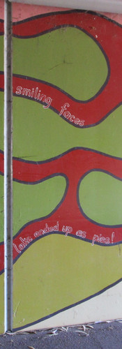
Backtrack to Luth Avenue and along Cunningham Terrace, crossing Stubbs Terrace to have a close look at 9 the Nash Street Pedestrian Underpass. Installed in 2003 under the railway line the underpass has been enhanced with artwork created by local school children, community groups and individuals. The images represent the importance of the land to all who live here.


The trail continues east on Stubbs Terrace along footpaths shaded by mature trees and cooled by verge gardens. Daglish was developed during the 1930s when distinctively styled Workers Homes Board houses were erected. Most of these remain today without significant alteration providing a valuable example of architectural styles of the time.

As you continue along Stubbs Terrace you can divert to the Hickey Street Playground or continue to return to the McCallum Avenue Precinct, the starting point of the trail. With the starting point opposite Daglish Railway Station this trail is easily accessible by public transport.

The full trail is just under 4.5km and took us about 60 minutes of walking time plus time to play on the playgrounds and to examine the Nash St Underpass Art. A shorter loop could take you from Cliff Sadlier Park to Mabel Talbot Park in a loop walk. It was a very pleasant walk as it is well shaded for most of the time. Toilets are available at Henderson Park.

You can download maps and information for the City of Subiaco Self Guided Walks including the Jolimont Daglish walk from: https://www.subiaco.wa.gov.au/see-do/things-to-see-do/self-guided-walks
If you are after a longer walk you could cross over Railway Road at the Nash Street Underpass and walk past Linton Kay Galleries (check out the high chair!) and turn down Herbert Road to get to Lake Jualbup where you could link up with the Walking Subiaco - Shenton Park walk. Or you can just enjoy a loop around Lake Jualbup which is what we did and this added on a couple of km and 30 minutes to our Jolimont Daglish walk.


To read blogs on other Walking Subiaco walks click on the links.
To read more blogs go to:
In the spirit of reconciliation Out and About- Family Nature Connection acknowledges the traditional owners of the Wadjak Boodjar (Perth land) and their connections to land, sea and community. We pay our respect to their elders past and present and emerging and extend that respect to all Aboriginal and Torres Strait Islander peoples today.


Comments